|
JOIN OUR MAILING LIST |
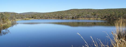
Monate falls within the Waterberg Mountain Range. The Waterberg Mountains are linked to the Sebetiela Mountains in the south-east, which in turn are linked to the Great Escarpment of the Drakensberg Mountain range at the Strydpoort Mountains.
The Rooiberg Mountains are located to the east of the reserve. Secondary drainage lines occur mostly along valleys in a northerly direction, bisecting the central topography. There is a marked drop in altitude to the south of the study area ending on the Springbok Flats.
In the north, the terrain becomes undulating and slopes down towards the Limpopo Valley, while flat plains occur to the west. The western part of the reserve forms part of Boshoffsberg Mountain Range.
The topography results in large variations in altitude within the study area with the lowestpoint being at 1120 metres above sea-level (m.a.s.l.) and the highest point at 1491 m.a.s.l.
| Back | Back to top |
